London Data Studio
A data science blog supporting local authority decision making through visualisation, statistical analysis, and modelling in London/Westminster.
Gallery
WCC EV Charge Point Map
A report detailing the current and planned electric vehicle charging infrastructure in Westminster
Internal LinkLondon Pavement Widths
Pavement widths in London for on-street asset planning and social distance measures.
Internal Link
Breathing City - TfL London Bikes Visualisation
An animation of TfL bikes throughout the week
Internal Link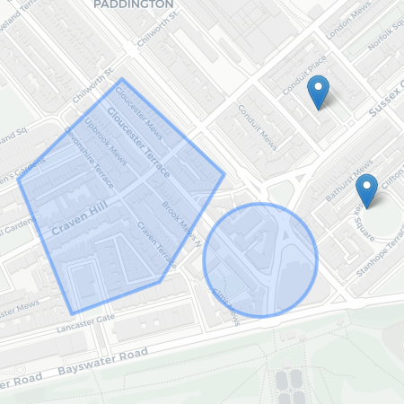
Blog


Data
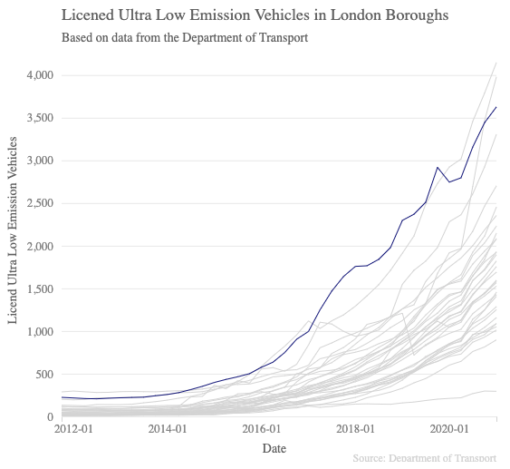
Westminster - Electric Vehicle Charge Points
A dataset containg all public electric vehicle charge points on the highway
Date Added: 22/10/10
Data Source: 5
External LinkBoundary Files
Output Area, Lower/Middle Super Output Area (LSOA/MSOA), Wards, Boundary. I am going to add much more padding to see if it speads out to the max width given the amount of space it has. I will repeat this same few sentances to increase the amount of words in this description. Output Area, Lower/Middle Super Output Area (LSOA/MSOA), Wards, Boundary. I am going to add much more padding to see if it speads out to the max width given the amount of space it has.
Date Added: 19/02/06
Data Source: 5
External Link